| Moorland Challenge | index |
| 1999 | 1998 | 1986 |
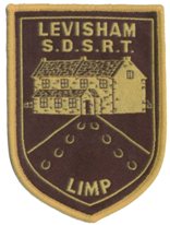
Levisham Limp
| Originator: | Scarborough Search & Rescue Team |
| Month: | March |
| Frequency: | No Longer Held |
| Distance: | 27½ miles |
| Ascent: | 3,300 feet |
| Time: | 12 hours |
| Location: | North York Moors |
| Maps: | Explorer 26, 27 |
| Awards: | Badge & Certificate |
| No. | Grid Ref. | Checkpoint |
|---|---|---|
| Start | SE 833 904 | Levisham Village Hall |
| 1 | SE 820 916 | Levisham Elbow |
| 2 | SE 788 935 | Stape |
| 3 | SE 750 929 | Hartoft |
| 4 | SE 724 955 | Rosedale |
| 5 | SE 724 976 | Northdale |
| 6 | SE 744 995 | Hamer Road |
| 7 | SE 804 983 | Stape Road |
| 8 | SE 840 958 | Needle Point |
| Finish | SE 833 904 | Levisham Village Hall |
 |
 |
 |
 |
 |
 |