 |
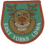
Rudolph's Romp
| Originator: | East Yorkshire LDWA |
| Month: | December |
| Frequency: | Held Annually |
| Distance: | 24½ miles |
| Ascent: | 2,400 feet |
| Time: | 10 hours |
| Location: | Yorkshire Wolds |
| Maps: | Explorer 293 |
| Awards: | Badge & Certificate |
|
| No. |
Grid Ref. |
Checkpoint |
| Start | SE 940 294 | Brantingham Village Hall |
| 1 | SE 934 301 | Woodale Road |
| 2 | SE 927 314 | South Cave |
| 3 | SE 927 326 | Long Drewton Lane |
| 4 | SE 897 327 | North Cave |
| 5 | SE 894 347 | Hotham |
| 6 | SE 897 391 | Houghton Lane Farm |
| 7 | SE 927 411 | Arras Wold |
| 8 | SE 929 375 | Newbald Wold |
| 9 | SE 931 318 | Great Wold Lane |
| 10 | SE 944 307 | Brantingham Dale |
| Finish | SE 940 294 | Brantingham Village Hall |
|


